

Map 2015
Ward Division Map (2015)
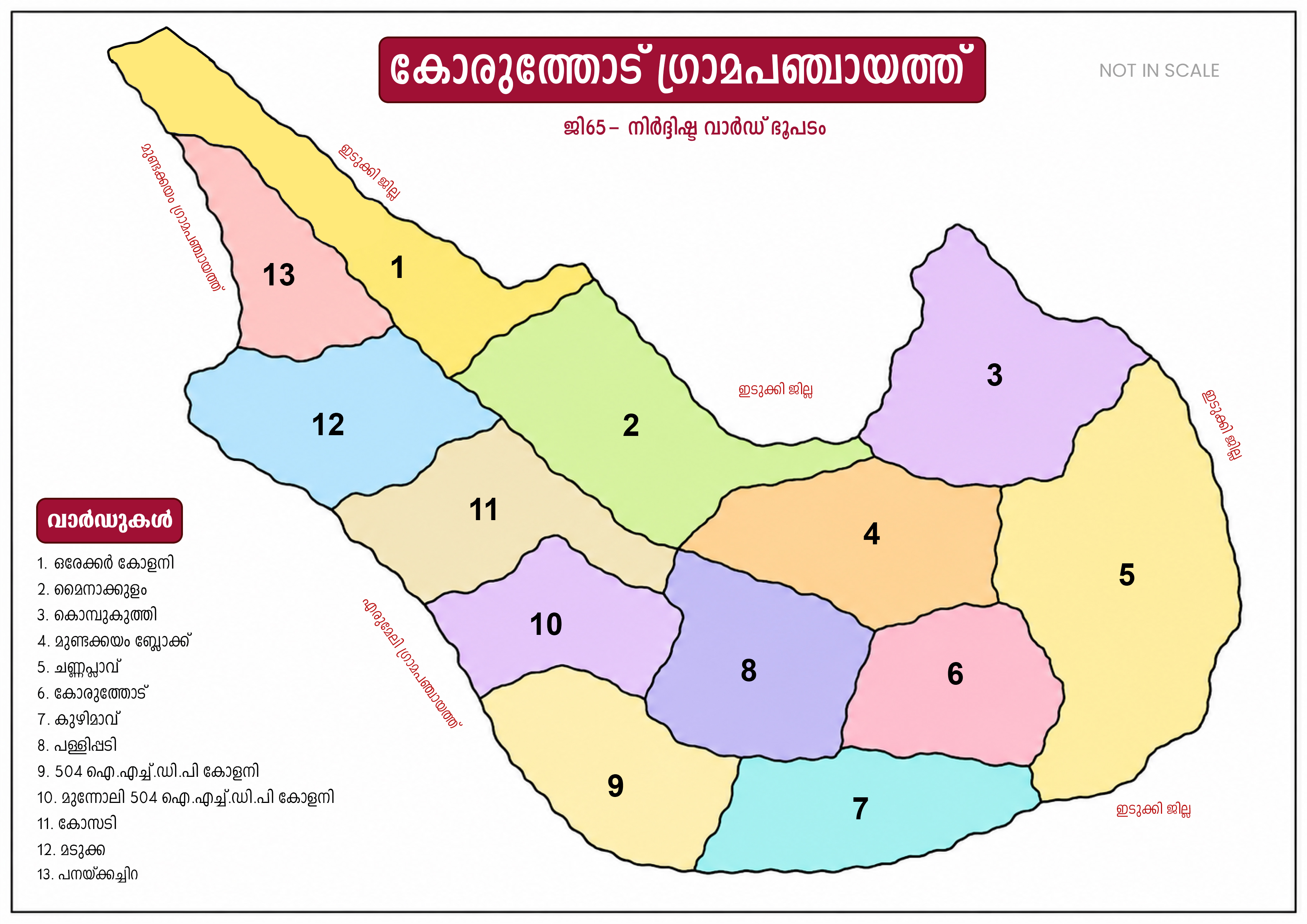
This is the administrative ward map prepared based on the 2015 ward reorganization of Koruthodu Grama Panchayat.
Wards
This map illustrates the geographical arrangement of the 13 wards that function as the basic units of the Panchayat administration, development activities, and public representation.
2015 Ward Division Map
Koruthodu Grama Panchayat 2015 Ward Map
Administrative boundaries and the division of 13 wards are visualized.
Features of the Map
Administrative Structure
Published to help the public understand ward boundaries and regional layout.
Development Planning
Useful for identifying development planning and ward-based data collection.
Public Representation
This map is also useful for identifying the areas of work of elected representatives.
Digital Preservation
The historical record of the 2015 reorganization is preserved digitally and made available to the public.
Note
This map was prepared based on the 2015 ward reorganization. If changes have subsequently occurred in the current ward boundaries, they may not be reflected in this map.
Koruthodu Grama Panchayat, spread across 13 wards, is a local self-government institution encompassing diverse geographical terrain and residential settlements. The arrangement of wards and administrative boundaries according to the 2015 ward reorganization is visualized in this map.


